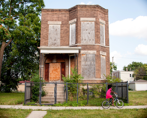
Growing up in Englewood – deemed one of Chicago’s most dangerous neighborhoods – photographer Tonika Johnson was perturbed by the rampant racial inequalities that plagued her city's residential areas. Her activist art often centers on her awareness of these disparities, and led to Chicago naming her a Chicagoan of the Year in 2017.
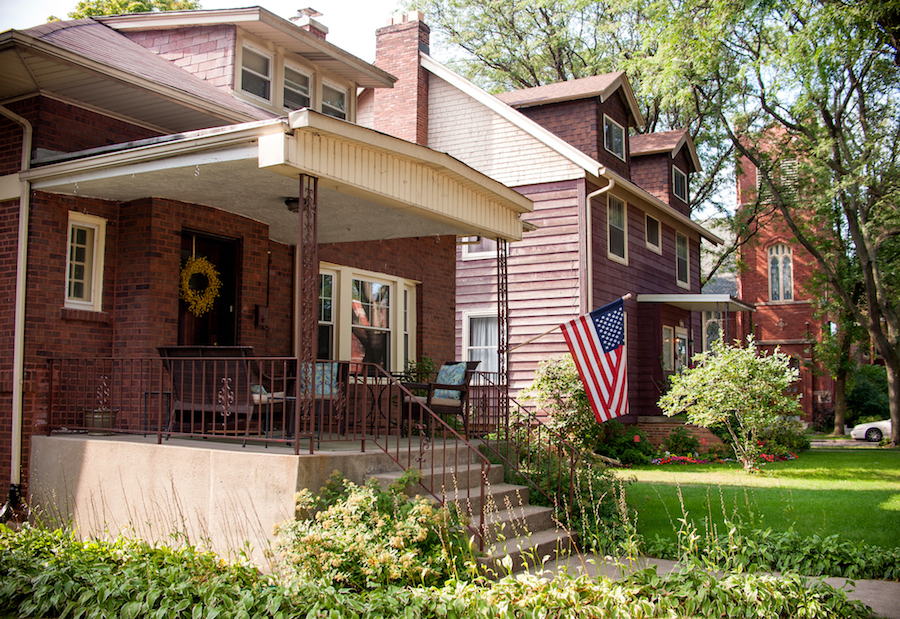
Johnson’s desire to educate people about systemic racism inspired a new project that is exhibited at the Loyola University Museum of Art through October 20. Titled “Folded Map,” this series explores issues of segregation and inequality by comparing North Side neighborhoods with South Side ones through a specific lens: Johnson photographed houses with similar addresses on the same street, but on opposite sides of the city. She also invited residents to have conversations about their neighborhoods, in an attempt to bridge regional divide and foster mutual empathy.
“We all want the same quality of life, and there are forces and historic systems that prevent it from being a reality.” Johnson says. Below, she talks about her latest project.
What do you hope to illustrate through this body of work?
At its core, "Folded Map" is about obvious historic inequities that exist in Chicago and the chasm it has created. "Folded Map" also aims to show the kind of human interaction required to bridge that chasm and gain better insight into the empathy required to break down these historic barriers. People need to be reminded and educated, in a very relatable and intimate way, about the longstanding history of segregation that Chicago residents of color are still operating within before we can all work together to repair it on an individual basis.
Segregation not only perpetuates stereotypes but also deeply diminishes and practically eliminates easy opportunities for residents to have meaningful relationships and valuable interactions with people from races and nationalities different than your own.
What drew you to create "Folded Map"?
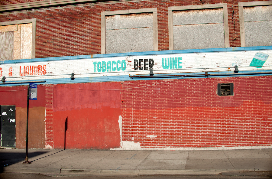
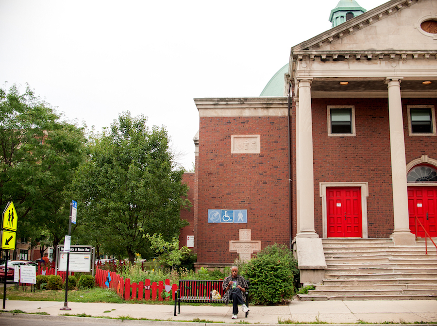
When I started high school, I traveled from Englewood to Lane Tech College Prep on public transportation everyday. I immediately noticed a lot of the streets were the same but the environment and landscape was completely different. My neighborhood had vacant lots, boarded-up homes, and predominantly fast-food restaurants and liquor stores, whereas the neighborhood around Lane Tech was simply more aesthetically pleasing, with a variety of eateries and boutiques as well as homes that were all lived-in and clearly expensive. These observations made a deep impression on me. Ultimately, they made me curious to know how and why these differences existed on the same named streets on the North and South Sides.
I also learned about photographer Gordon Parks while I was a teenager, and I fell in love with his work. Parks was photographing black people in the same way I saw us: dignified and resilient. That is when I realized how photography can amplify awareness and offer a unique way to understand a longstanding social issue. After that, I knew I had to put my life-long observations into a project to help elevate the many issues my fellow Englewood residents work so hard to resolve that are rooted in our city’s history of segregation.
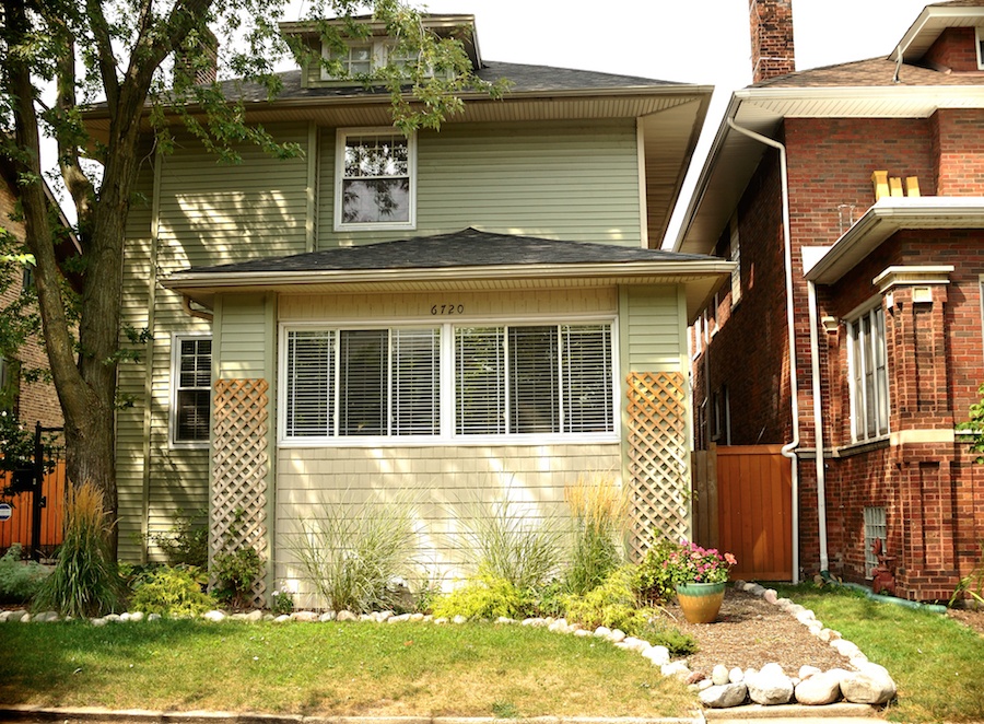
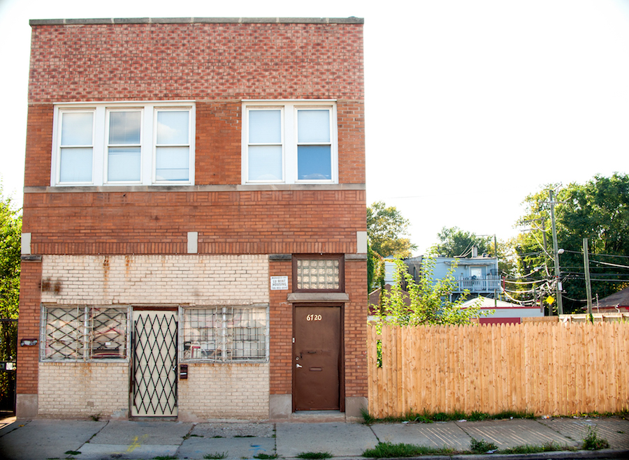
Why did you choose to interview residents in addition to photographing houses?
The addresses I identified in all of the neighborhoods included residences. As I was taking photos of my first “map twin’s” home, the North Side homeowner, Jennifer Chan, came out and greeted me very sweetly but inquisitively — basically, asking why I was taking photos of her house. I explained my project to her, and she was really intrigued and invited me to their block party, where I met her neighbors and thought about them meeting an Englewood resident. I asked her and her husband Wade, and to my surprise, they agreed. I asked Englewood resident Nanette if she would meet Wade and Jennifer, who had never been to Englewood, and she agreed. Once they met, and I asked them questions together about their neighborhoods, I knew I had to do more pairings because their conversations were so compelling to the point I felt like I was eavesdropping on a very intriguing social experiment.
It hit me that this was an example of the kind of human, Chicagoan-specific interaction that needed to happen to make "Folded Map" "touch."
What about those interactions stood out to you?
What moved me the most and continues to shock me is the willingness they had to participate in "Folded Map" and use it a tool for them to have a meaningful learning experience. I was also shocked by how empathetic everyone was to each other although they were talking to people who had very different life experiences from their own. These residents really helped me restore some of the hope I was starting to lose about Chicago improving.
My first map twin interview was with Wade, a white male resident of Edgewater and Nanette, a black female resident of Englewood. I knew this was powerful when Wade and Jennifer met Nanette at her home for the first time. Nanette was describing what her neighborhood was missing, and Wade told her he hated that she didn’t have access to all the things she needs like him, and that he felt guilty about it because it’s not fair. I could tell instantly that Nanette appreciated him acknowledging this.
What did Englewood residents say was missing from their neighborhood?
There aren't a diverse variety of grocery store options, and the few that are in the neighborhood are not within walking distance. There is only one cafe plus the recent Starbucks. We are missing quality schools and alternative public gathering spaces. There are no sit-down restaurants, no cute boutiques, no greenery, or streets lined with large beautiful trees. The streets are bumpy and filled with potholes, and public transportation doesn't run as frequently or on time as it does on the North Side.
How will "Folded Map" continue to evolve?
The overwhelming interest and positive response it has received has encouraged me to want to not only continue and expand it but also create a curriculum for it so it can be an educational tool. I am also contemplating making the video interviews into a web series on YouTube, as well as a possible oral history book.
Folded Map runs through October 20 at the Loyola University Museum of Art.


