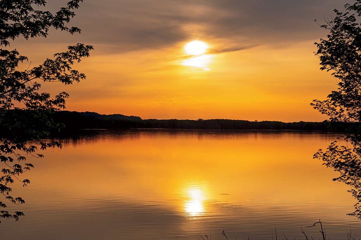
Is it past this playground?” I ask Dave.
“Just past the playground.”
“Where?”
“Behind those houses.”
“Are we in Wisconsin?”
“No. We’re still in Illinois.”
I have just driven a rented Nissan Altima up a roller-coaster-steep hill rising away from the two-block, two-story brick downtown of East Dubuque, in search of the Mississippi River. Not its source, which is far to the north, in Minnesota, but the point where it flows into Illinois. Once the river reaches our state, it drifts along it for another 580 miles, as the catfish swims, to Cairo. That’s a longer journey than the Mississippi takes past any other state. Yet even though the Mississippi defines our state’s western border, Illinois is little associated with the river’s lore — not as much as Missouri, which produced Mark Twain, or Mississippi, which produced the Delta blues, or Louisiana, where it empties into the Gulf of Mexico, just past New Orleans.
Along with Dave, the photographer assigned to accompany me, who is navigating from the passenger seat with Google Maps on his phone, I am about to travel those 580 miles over the next five days to give Illinois its due as the Mississippi-est state in the union — and to explore the towns that dot its western edge, so often overshadowed by the skyscrapers of the modern metropolis on a Great Lake. (I inquired about procuring a boat, as English author Jonathan Raban did to write Old Glory: A Voyage Down the Mississippi, one of my favorite travel books, but was told I could not pilot it the nearly 600 miles to Cairo. “We can’t send someone all that way if it breaks down,” said the woman at Fun ’n the Sun Houseboat in Alma, Wisconsin. So we rented this car. It was the right decision. As we would soon find out, the Upper Mississippi is too far above its banks for navigation.)
“This looks like Pittsburgh,” says Dave as we slide back down East Dubuque’s slope. Illinois’s prairie flatness has collided with the Mississippi, producing the ridges and bluffs of a river town. High above U.S. Highway 20, Timmerman’s Supper Club looks down from its aerie. Dave lives in Chicago but travels all over the country for assignments and still carries a driver’s license from his native Washington State. The weekend before, he photographed the Kentucky Derby in Louisville. My work is confined to Illinois. I just finished writing a book about Abraham Lincoln and Stephen Douglas. Seeking out all seven debate sites — Ottawa, Freeport, Jonesboro, Charleston, Galesburg, Quincy, and Alton — felt like an adventure equal to visiting the seven continents. If I cannot travel widely, I will try to travel deeply.
Paul Theroux, the world-renowned travel writer, once told me, “It’s hard to write a travel book about the place where you live.” He said this to me after I handed him a copy of The Third Coast, my Great Lakes travelogue, which I’m sure he never read. I live on the Great Lakes, though, not the Mississippi. Can I find the exotic in what is, to me, the backwater of Illinois? And can I introduce my traveling companion to the magic of Illinois?
“Magic” is not a word much applied to our flat, Middle American state, but it’s something I feel while driving across the prairie at twilight, fireflies exploding on my windshield, and while standing in the long shadow of a Lincoln statue or watching a train of barges leave a rippling wake on the Mississippi.
At the bottom of East Dubuque’s hill is Shorty’s Saloon: $2 cans after 4 p.m. It’s only 3:30, but what the hell.
“How much are cans before 4?” I ask the bartender.
“Tuna quarter,” he says, reminding me that we’re only a mile from Wisconsin.
I order a Busch Light. “We’re at the beginning of a five-day journey,” I tell the bartender, “from East Dubuque to Cairo.”
“Cairo,” he says quizzically. “I’ve never even heard of that. Couldn’t tell you where it is.”
When I get to Cairo, I resolve, I will ask folks if they’ve heard of East Dubuque.
“Don’t go to Galena,” the bartender advises. “Galena’s not a river town. It’s a tourist trap. You have to go to Chestnut Hill to see the river.”
“We’re going to the Mississippi Palisades in Savanna,” I respond. That’s a one-stoplight town 45 miles downriver from East Dubuque.
“Well, be sure to go to Poopy’s in Savanna. It’s a great biker bar.”

North of Savanna, we swim in the Palisades.
— Sufjan Stevens, “The Predatory Wasp of the Palisades Is Out to Get Us!”
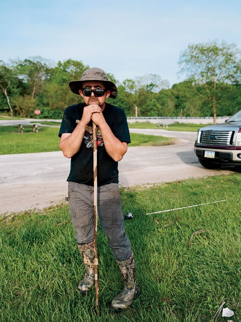
Early May is the end of mush-a-roonin’ season in Illinois, when morels still poke their filigreed caps from the mulch in damp, shady woodlands. Atop the limestone cliffs of the Mississippi Palisades State Park rise old-growth elms and cottonwoods, their trunks forming a prehistoric creature with a thousand legs. English ivy, mayapple, and sweetroot grow in the gloom below. These conditions are perfect for morels, which Jay Anderson and his family are gathering in plastic shopping bags.
“Illinois, Iowa — right now in central Iowa — they’re finding tons of morels,” says Anderson, his hair and his Monster Energy T-shirt both lank with sweat. “We didn’t get rain until the other day.”
Anderson, who is from Savanna, shows me one of his finds; its honeycombed crevices make it look like a petrified rock turned to flesh.
“Most people roll ’em in egg and breadcrumbs and crackers. I don’t care for ’em myself. I love huntin’ ’em. The kids like ’em. They eat ’em.” (His wife provides the recipe for frying a morel: Cut it in half and soak in saltwater for a day to kill the bugs, then dip in egg, roll in saltine crumbs, and fry in three tablespoons of butter for about five minutes a side, until brown.)
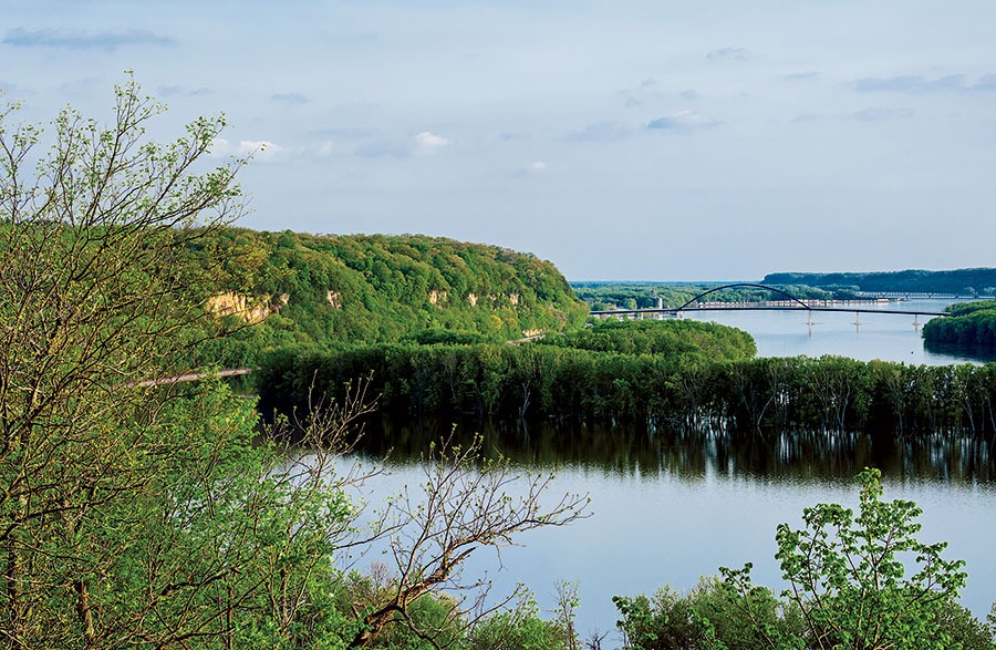
“This is pretty epic,” says Dave, the photographer, as we stand at Lookout Point. Below us is Buffalo Lake, a channel green with forested islands separating Illinois from the Iowa shore. “I wish the rest of Illinois looked like this. It’s a shame alcohol is prohibited. You could sit here and watch the sun set.”
At 5:30, though, the sun is still too harsh for landscape photography, so we drink beer at Poopy’s until the magic hour. (There is only one bike in the parking lot, but on display inside are Harley-Davidsons and plenty of biker attitude: Confederate flag caps, a “God Fearin’, Gun Totin’, Freedom Lovin’ American” T-shirt, and a “J.B. Pritzker Sucks … the Life Out of Small Businesses” poster beneath a TV tuned to Newsmax.)
The Mississippi was once among the nation’s busiest commercial thoroughfares, plied each year by thousands of flatboats, steamboats, keelboats, and barges, but this evening it is empty. Looking downstream, I see the palisades: buff-colored rock peeking out of enveloping trees. An iron bridge with a single metal arch spans the river, connecting Savanna to Sabula, Iowa’s only inhabited island. The river winds in a backward S before disappearing between banks of greenery. In the distance, the water looks smooth, but close to the bank, it ripples as though pattered by raindrops. A freight train hums and scrapes through the gap between the outlook and the water; the railroads, which reduced the Mississippi’s commercial relevance, follow its course. Even Mark Twain commented on that in 1883. “The railroads have killed the steamboat passenger traffic by doing in two or three days what the steamboats consumed a week in doing,” he wrote in Life on the Mississippi.
That Rock Island Line is a mighty good road.
— Lead Belly, “Rock Island Line”
“We’re going to see barges,” I tell Dave the next morning in Rock Island, where we had spent the night. The town is exactly 100 miles downriver from where we began our journey.
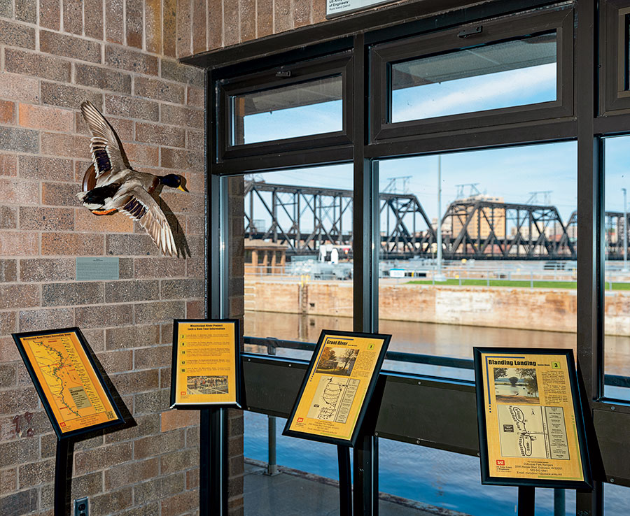
He is not excited. It’s too early for artistic photographs. The light is too harsh. Also, only boat nerds, the nautical equivalent of train spotters, get excited about watching barges. The Army Corps of Engineers built a visitor center and viewing platform next to Lock and Dam 15 — the largest roller dam in the world — so folks like me can enjoy the thrill of watching grain-laden barges float by. The show draws 50,000 a year. The river is intermittently dammed to ensure a deep enough draft for traffic. The locks enable barges and towboats to pass around.
Barges ferry a significant portion of the state’s corn and soybean crop up and down the Illinois and Mississippi Rivers. During fall harvest season, 12 to 15 trains pass through Lock 15 every day. Barge operators boast that theirs is the most cost-effective and environmentally friendly form of transportation. A single barge holds 62,492 bushels of corn — as much as 16 railcars or 70 tractor-trailers.
The visitor center is on an army base — Rock Island Arsenal, established during the Civil War to manufacture weapons — so barge watchers must endure a security check. A sign in the processing room specifies that felons, sex offenders, and anyone convicted of “espionage, sabotage, treason, terrorism or murder” will be prohibited from seeing barges. I stand in line behind a man with a shirt announcing, “This Is America. We Eat Bacon. We Drink Beer. We Own Guns. We Speak English. We Love Freedom. If You Don’t Like It, Leave.” He passes. He’s no traitor. Dave and I pass, too, but we see no barges.
“Not today,” announces Gene Sperry, a retiree and volunteer. “We haven’t seen a barge for two weeks. The river got up to 21.6 feet. There was a pretty good snowpack up in Wisconsin, Minnesota, and Canada. Pretty fast melt. Normal pool is seven feet. Flood stage is 15.”
The lock was built in the 1930s, so the numbers on the depth gauge are mosaics, like those in the swimming pool of an art deco YMCA. The water has risen to 19, a few feet from the top. “The barges displace nine feet of water,” Sperry explains. “Those boats would wipe out the railing and float away. In Muscatine, their lock was completely flooded. We’re waiting for the river to get down to 18 feet. I think by tomorrow we’ll start seeing some traffic.”
In the meantime, Sperry tells us, we might see a barge at Lock 19, in Keokuk, Iowa, 115 miles downstream, where the flood has petered out.
It happens out in Vegas, happens in Moline.
— Bob Seger, “The Fire Down Below”
Jonathan Raban, who was an arch crank even in his 30s, as those who spend too much time alone on a boat will become, described the Quad Cities as “a queer agglomeration” in his 1981 book Old Glory. Rock Island, Moline, Davenport, and Bettendorf “hadn’t come together to make a metropolis, but they had lost their identities as individual towns,” he wrote. “For twelve miles, they straggled lumpishly along the wharves, the hard angles of their warehouses, steel tanks and factories hemming in the river. Everything was too low, too spread out, to make much more than a cheeky gesture of encroachment on the Mississippi, like a line of children’s sand castles on a seashore.”
At 42,418 inhabitants, Moline, a few miles east of Rock Island, is Illinois’s largest Mississippi River city. It’s the headquarters of a Fortune 100 company — John Deere — but it’s no Minneapolis, St. Louis, Memphis, or even Davenport, the unofficial capital of the Quad Cities and the third-largest city in Iowa. Perhaps that’s the reason the Mississippi attracts so little attention in Illinois, even from Illinoisans. Dave is very excited about visiting the confectionery Lagomarcino’s, which advertises itself with a half-burnt-out blue-and-orange neon sign jutting over the sidewalk on Fifth Avenue. The sign is not quite as old as the business — which was opened in 1908 by immigrants from Lagomarsino, Italy, and is now run by their granddaughter — but it’s old. “I’m 72, and that sign’s been there longer than I have,” Mary Beth Lagomarcino tells us. “We’re trying to get it fixed with a grant from the National Historic Trust.”
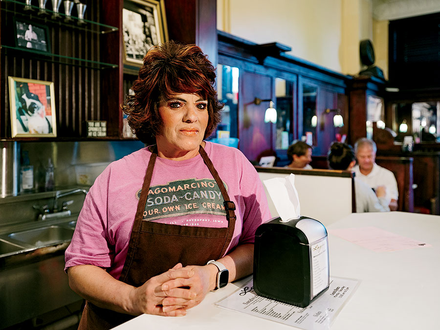
Andy Hardy might have patronized Lagomarcino’s. So might Archie Andrews. It is one of the rare surviving soda fountains, with dark wooden booths, a pressed-tin ceiling, hexagonal floor tiles, and a candy counter selling white chocolate almond bark and pecan turtles. Dave is so enthralled by this portal into a bygone America that he asks the counterman — Daniel Lagomarcino Otter, Mary Beth’s son — to build a hot fudge sundae and a Green River float. (The Lagomarcinos have broken the third-generation curse, which states that the founders’ grandchildren fumble away the family business. They’re onto the fifth generation: Mary Beth’s 14-year-old grandson served ice cream at an outdoor concert.) Mary Beth, eager to entertain curious travelers, brings out a copy of Sweet Memories: The Lagomarcino Story, by Bill Wundram, who spent more than 70 years as a columnist for the Quad-City Times and its predecessors. The book is not only a store history but also a family album, beginning with Mary Beth’s grandfather Angelo.
When Mary Beth has traced the family tree to her own generation, I ask her about Moline’s relationship to the Mississippi. Like so many cities with a factory-cluttered waterfront, Moline has recovered the waterway that once served as the source of its industrial prosperity and converted it into a recreational amenity. As the commercial importance of the river has declined, those who live along its banks are coming to see it as more picturesque than practical.
The Mississippi “used to be our back door,” she says. “Now it’s our front door. The factories used to be along the river. It was dirty. Then John Deere built their pavilion. They built four hotels downtown, which my father wouldn’t believe. There’s the Celebration Belle riverboat, a water taxi, and bike paths along the river all the way to Wisconsin.”
We eat halfway through the ice cream confections that Daniel prepared as photo props. Mary Beth doesn’t charge us for them — a perk of traveling down the river in the name of a regional magazine. We do pay for our grilled cheese sandwiches and tip the waitress, who Dave thinks has a “Lucille Ball look” befitting the vintage of her surroundings.
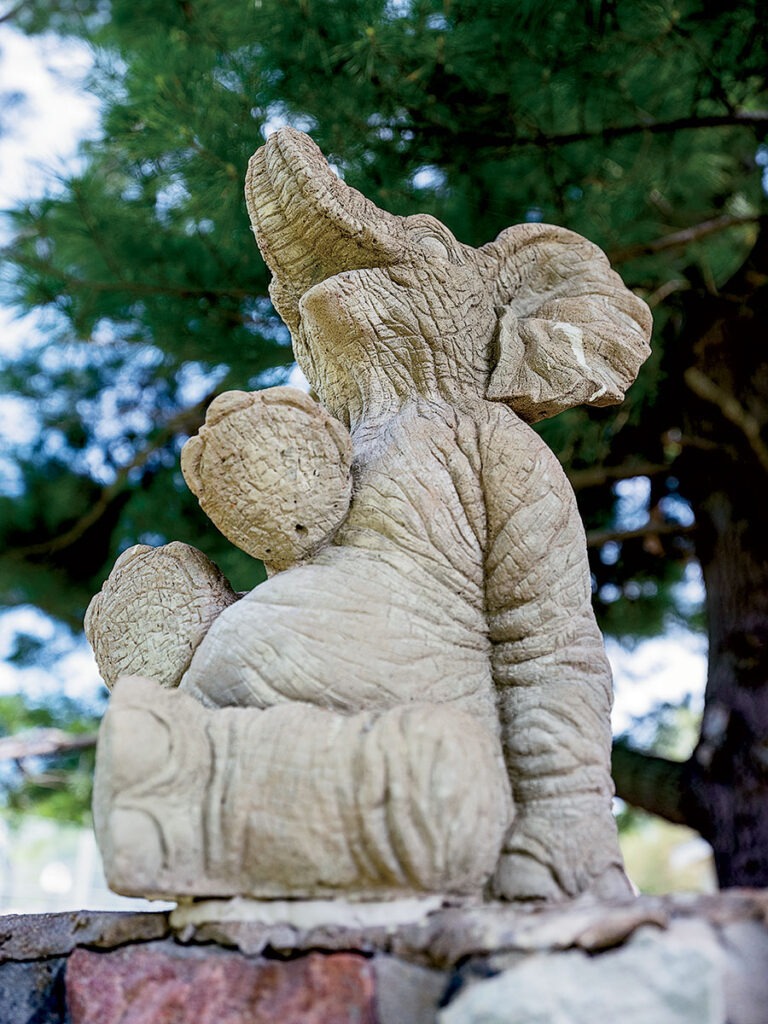
Every tavern in every small town along the Mississippi promotes the same two enticements: $2 cans of Busch beer, advertised with a metal sign, and video slots, advertised with flapping vertical flags. We stop in Oquawka, population 1,134, about halfway between Rock Island and Quincy, for a roadside attraction: the grave of Norma Jean the elephant, star of a traveling circus, who was killed on July 17, 1972, when a lightning bolt struck the tree to which she was tethered by a metal chain. She was buried where she fell, in the town square. Recognizing its claim to fame, Oquawka built a shrine above Norma Jean’s remains, topped by a capering concrete elephant, and held a 50th anniversary memorial last year.
The Mississippi “used to be our back door,” says the owner of a confectionery in Moline. “Now it’s our front door.”
Drinking Consultants LLC is one of the only bars in Oquawka. I order a Busch Light; the photographer orders something fancier. I sit down to play the slots. Illinoisans wager $2.8 billion a month on video gaming, bringing in more than $80 million in tax revenue — most of it from people who can’t afford more than $2 for a beer. An experienced player at the next terminal over guides me through the commands. I win $3 on a Wheel of Fortune–type spin. That’s enough to pay for the beer, so I cash out.
“The secret to winning at gambling is to quit while you’re ahead,” I tell the bar at large. I don’t think anyone is listening.
We continue driving south, nearing the point where, across the river, Iowa turns into Missouri. At times, the state highways and county roads bring us so close to the overflowing Mississippi that water creeps up nearly to the asphalt. At other times, we pass cultivated green fields, protected from the river by bluffs. Dave stops to take a picture of a man fishing from his truck, a silhouette of figure, pole, and filament.
“This looks like Louisiana,” he says.
Farewell to Nauvoo, in the desert we roam.
— Lisa Arrington, “Farewell to Nauvoo”
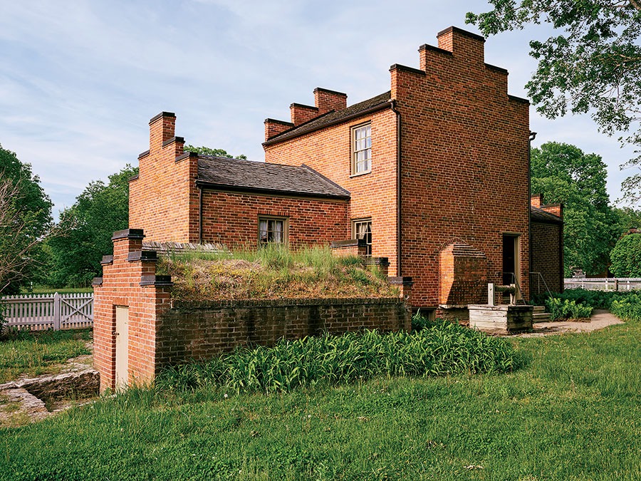
Nauvoo is both a holy city and a tourist trap: two designations that often go hand in hand. In 1844, it was a city of 12,000 — the same as Chicago then — most of them followers of Joseph Smith, founding prophet of the Church of Jesus Christ of Latter-day Saints. Converts arrived at the steamboat landing and were baptized in the river. After Smith was lynched by anti-Mormon mob at the Hancock County Jail in Carthage, one of his lieutenants, Brigham Young, led most of the city’s Mormons on a cross-country flight from Illinois to a remote valley in what is now Utah, where no one could prevent them from practicing their religion.
Smith’s body remained behind, and his grave has become a place of pilgrimage for the world’s 17 million Mormons. With so many well-to-do visitors, Nauvoo is set up more like an Up North resort than a grain elevator port: Fronting Mulholland Street are a bookstore, a fudge shop, an art gallery, and an antiques boutique. To avoid offending the teetotaling Latter-day Saints, the only bar is concealed inside the Hotel Nauvoo.

North of Mulholland Street, Nauvoo has been re-created as it was in Smith’s time by Mormons who returned to reclaim the land from which they were expelled. With its magnificent white temple, surmounted by a golden statue of the Angel Moroni, Nauvoo belongs as much to Utah as it does to Illinois. But even that Nauvoo is divided, as I learn when I take the 4 o’clock tour of Smith’s home and grave. Those sites, close by the river, are administered by the Community of Christ, a branch of Mormonism founded by Joseph Smith III. After his father’s murder, the younger Smith remained in Nauvoo with his mother and rejected the practice of polygamy. The tour is led by a retired history professor from Washington State, a lean, white-haired, bespectacled man who spends a month each year in Nauvoo, as a sort of mission. The other tourists are Steve and Diane, a middle-aged couple originally from Utah. They wear floppy hats and hold hands throughout the entire tour. Steve instigates a theological debate when the professor refers to Smith’s “first wife.”
“What do you mean, his ‘first wife’?” he asks.
“He was a polygamist,” the professor asserts.
“No, he wasn’t.”
“I’m not going to argue. Most historians believe Smith was a polygamist.”
“I was taught my whole life he was; now I believe he wasn’t,” Steve says with placid assurance.
“Let’s just talk about the historic site today and leave the theology alone,” the professor says finally, leading us to a granite marker above the graves of Smith, his wife, and his brother Hyrum, who was also lynched at the jail.
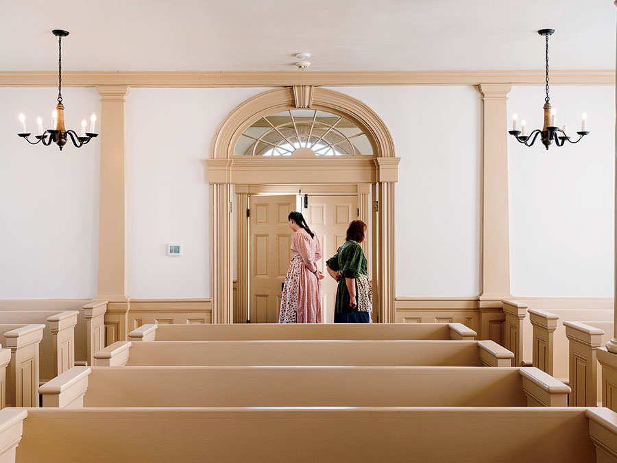
“This is our main attraction,” the professor says. “This is why people come here. There are many who say they feel the presence of God.”
“It’s going to Mecca,” agrees Steve, who is making his second visit. “It’s a sacred place.”
Nauvoo is “a Colonial Williamsburg for Latter-day Saints,” says the professor. That description better fits the half restored by the Utah-based church. Its re-creation of old Nauvoo displays the Mormon tendencies to order, organization, and wholesomeness. Brigham Young’s house still stands, though now with an air conditioner. Sheep and cattle graze in split-rail pastures. Vintage brick storefronts are designated “Gunsmith,” “Post Office,” “Printing Office,” “Tinsmith,” “Bakery.” Women in calico dresses ride bicycles, wearing black-and-white missionary name tags, waving at every passerby.
“They’re the nicest people,” Dave tells me. “One of them asked me about my spiritual beliefs. I told him I’m an agnostic. He looked me in the eye and said, ‘I appreciate your being honest with me.’ I’ve never seen happier people in my life.”
Because they’ve finally made it back home.
See beautiful Washington Park and the famous Mississippi / There’s Quincy College, Baldwin Field, and the Arogee Indian Mounds.
— Harold Kirsch and Euel Box,“ Quincy, Quincy, My Home Town”
Like most river cities, Quincy once had high hopes. After the Mormons’ flight, Quincy took Nauvoo’s place as Illinois’s second city and imagined it could dominate the Mississippi River trade.
“Quincy was born on the Mississippi,” historian Reg Ankrom tells us over a plate of prime rib on the patio of Kelly’s Tavern, a roadside joint that’s about a mile east of the river, in Quincy’s inland creep. “It’s the only natural landing for steamboats. The river was the attraction. It was a Sac and Fox trading post, broken up by Zachary Taylor. Quincy supplied products to the South: food and meat. Quincy at one time, in the 1830s, tried to compete with Cincinnati and St. Louis, but St. Louis made more use of the river than Quincy did. Then the river trade declined when the railroads came in the 1850s.”
Ankrom, a local squire with a Ted Kennedy–esque head of white hair, has written two books on Stephen Douglas, who represented Quincy as a congressman but moved to Chicago after his election to the Senate because he foresaw that Illinois’s greatest city would grow up where the railroads met the Great Lakes. On Quincy’s downtown square, surrounding Washington Park, where Douglas’s debate with Lincoln is commemorated with a bas-relief by Chicago sculptor Lorado Taft, classical 19th-century façades tell stories of a river city’s fall. A bank became a music store became “Storefront for Rent.” Beneath two rows of boarded-up windows is a nameless tavern offering Bud Light and slots. The eight-story Lincoln-Douglas Hotel is now the Lincoln-Douglas Apartments, reserved for low-income seniors.
On the side streets, though, the riverboat money left behind a collection of the most ornate residential architecture in Illinois: Quincy’s four historic districts contain examples of just about every architectural style popular in the late 19th and early 20th centuries: Queen Anne, Romanesque, Italianate, Second Empire. No dwelling, in Quincy or anywhere else in Illinois, is as baroque, rococo, ornate, flamboyant, overdecorated, or whatever synonym Roget’s offers as Villa Kathrine, a miniature Moorish castle on a bluff overlooking the Mississippi that we visit the next day. George Metz, a local heir, traveled the world in search of the perfect home and found it at the Villa ben Ahben in Algiers, which he reproduced on the banks of the Mississippi.
The desert-colored dwelling, built in 1900, is strikingly colorless against green Midwestern grass and blue Midwestern sky. A turquoise minaret tops a square tower. A crescent moon rises above a dome. Inside, the floor of a grotto is embellished with intricate Moorish design. Curved white columns rise toward a hanging lantern that glows through kaleidoscopic glass panels.
Metz hired belly dancers to perform in the courtyard. He designated one of the small upstairs bedrooms as the “harem room,” but he lived alone, with a 212-pound Great Dane named Bingo. Metz eventually abandoned Villa Kathrine, ending his days at the Lincoln-Douglas Hotel. In 1978, with the castle deteriorating, a nonprofit was established to save and restore the property. The Quincy Area Convention and Visitors Bureau now uses it as a headquarters and to draw travelers on the Great River Road, a riverside route marked with paddle-wheel-shaped signs.
“I feel like I’m entangled and involved with the river,” says Holly Cain, the bureau’s executive director. “We see so many who come through who are traveling the River Road. It’s a driver to our city.”
Later, over a catfish lunch at Riverside BBQ and Grill, one of 20 restaurants on the Tri-County Catfish Trail (the fish were once caught in the river but are now raised on farms), Ankrom questions the Mississippi’s importance to modern-day Quincy. “Quincy thinks of itself as more sophisticated than a river town,” he says. “I never have any association with the river. It’s just there.”
Every road trip needs music. Our road trip needs Illinois music. Along Highway 100 the next morning, near the spot where the Illinois River flows into the Mississippi and 15 miles upriver from Alton, Dave cues up a Miles Davis album on his phone. Miles Davis was born in Alton, which calls itself the Birthplace of Cool.
“When in Rome,” he says.
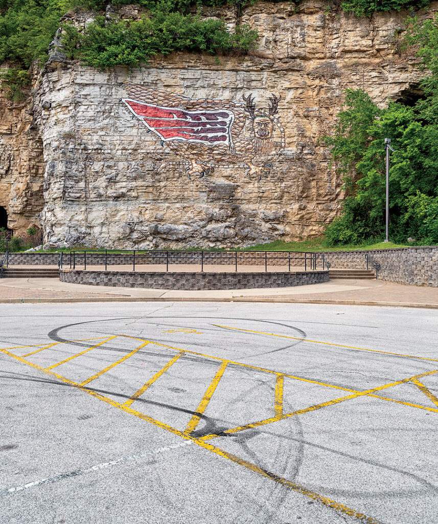
In addition to its own music, Illinois has its own mythology, and its own mythological creature: the Piasa Bird. The Piasa (pronounced PIE-uh-saw) is painted on a limestone bluff just north of present-day Alton, but that painting is a re-creation. The original pictographs were documented by Father Jacques Marquette, the French Jesuit missionary who explored the Upper Mississippi in 1673. He found the paintings terrifying: “They have horns on their heads like those of a deer, a horrible look, red eyes, a beard like a tiger’s, a face somewhat like a man’s, a body covered with scales, and so long a tail that it winds all around the body, passing above the head and going back between the legs, ending in a fish’s tail.”
The original Piasa paintings were effaced by time, the elements, and limestone quarrying. A steel replacement rusted. Local artists have painted a Piasa alongside the road into Alton, but its permanence and artistic distinction barely rise above graffiti. The outline of the body has faded into the limestone, and the red, white and blue tail resembles the logo of the New England Patriots.
I been to Chicago and I been to Detroit / But I never had a good time till I got up in Illinois.
— Skip James, “Illinois Blues”
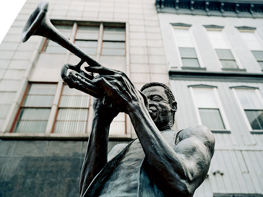
Alton is haunted. Ivy Watson has seen ghosts. Watson, a 22-year-old graduate of Alton High School, is lounging beside the Miles Davis statue on Third Street, along with her partner, Dakota Howland, and her infant son, Kirin, who is napping in a stroller. Miles arches his back, blows his horn. Across the street is the unlit neon sign of the shuttered bar Mac’s on Third, its entrance barricaded with gray plywood.
“We have a lot of haunted mansions,” Watson explains. “That’s what Alton is known for. Up on East 20th Street, near the McPike Mansion, I tripped and fell and lost a hundred dollars from my purse. Something spooked me.”
Watson grew up in the Hotel Stratford, a block from where we’re sitting, where Third Street begins a climb so steep it could be transplanted to San Francisco. Fallen from elegance, the Stratford has been abandoned, except for the offices of a radio station. During Watson’s childhood, it was only three-quarters abandoned. Spooks inhabited the emptiness. “You had the main entrance area, and only the first floor was occupied,” she says. “We used to play with the little ghosts, me and my sister. They were white wisp figures. We could never get close to them, but they showed up in corners of rooms: the ballroom, the hallway.”
Across the street from the old hotel, at the Grand Theatre, unlit bulbs dangle from a faded, flaking marquee. “There was a woman who stood in the window,” Watson says of the theater. “She’d wave at us. She’d smile at us. We used to go in the theater to play. We would hear her voice, but we could never see her.”

Is Watson making this up? If she is, she’s seeing the same poltergeists as the rest of Alton, which has been called America’s Most Haunted Small Town. The McPike Mansion is open for paranormal tours. Alton has ghosts. It also has statues — Miles; Robert Wadlow, at 8-foot-11.1, the tallest man in history, born and raised in Alton; abolitionist Elijah Lovejoy, lynched by a pro-slavery mob here in 1837. As in most downstate cities, though, its living population is declining, from 43,047 in 1960 to 25,422 today.
The Argosy Casino Alton, the oldest casino in Illinois, opened in 1991 as the Alton Belle. Riverboat gambling was introduced to revive the old river ports. A local politician predicted the Belle would “breathe new life into Alton.” In a process resembling mammalian evolution, the casinos first cruised the river, then were moored to docks, then were simply born on land, although gambling is still referred to as “going to the boats.”
The Argosy is isolated from downtown by four-lane Landmarks Boulevard — past the Lincoln and Douglas debate statues and the grain elevator with a red line marking the 42½-foot high-water point of the 1993 Mississippi flood, which swamped downtown Alton, causing the streets to buckle. Inside the casino, almost every gambler is playing slots — just like in the bars. A few blackjack dealers look hopefully at passing customers. Any money a casino attracts to a town tends to stay in the casino. A few miles downriver, we spend the night at the DraftKings at Casino Queen hotel, directly across the Mississippi from the Gateway Arch — another island of luxury surrounded by blight. In the morning, I run across the Eads Bridge to St. Louis, stopping midspan to look down on towboats pushing barges upriver.

The Illinois side of the Mississippi between Alton and the Kaskaskia River is known as the American Bottom. With alluvial soil far more fertile than that of the prairie, the American Bottom is the longest-settled part of Illinois, and one of the longest settled in America. Here the peoples of the Mississippian culture built Cahokia, which by the 11th century had 20,000 residents. That was larger than any subsequent city in what’s now the United States until 1780, when the figure was surpassed by Philadelphia.
In Cahokia were well-organized villages, constructed around public plazas. The inhabitants played chunkey, a ceremonial game that involved hurling poles at rolling disks. Most significantly, the Cahokians constructed giant earthen mounds, which remain to this day, the oldest remaining manmade structures in North America. The largest of these, Monks Mound — 100 feet tall, with 25 million cubic feet of dirt piled up over 150 years on a 15-acre footprint — was the seat of the Great Sun, Cahokia’s theocratic chieftain. Today, it is popular with joggers getting in hill repeats and hikers seeking a hazy view of the St. Louis skyline.
At the summit, we meet Cornell Douglas and his four young children, who are visiting from Belleville. “This is sacred land,” says Douglas. “You can feel the good vibes. People in Chicago don’t even know about this. They don’t think it’s in Illinois.”
The French were attracted to the American Bottom for the same reason as the Mississippians. French settlers began migrating to the area in the late 17th century, making the Illinois Country the linchpin of a fur-trading empire that formed a great crescent from Montreal to New Orleans. (That’s why the s in “Illinois” is silent.) The military outpost of Fort de Chartres contains the oldest stone building in Illinois, a powder magazine. The French surrendered the fort to the British in 1763, after losing the French and Indian War. Fort de Chartres was partially reconstructed by the state in the 1930s; its museum’s guest book is usually signed by “two or three visitors a day,” says Jennifer Duensing, president of Les Amis du Fort de Chartres, and the only other living being on the parade grounds when I wander through the limestone gate. The exception is the annual Fort de Chartres Rendezvous, held the first weekend in June, when 2,000 people — perhaps the entire subculture of French colonial buffs — gather to reenact the French and Indian War and peddle baskets or pots. Had the French won that war and held on to their North American possessions, the Mississippi River valley and the Great Lakes would have become a Gallic nation with a large Native underclass. The French traded with Natives, converted them to Catholicism, and married them to build relations with the local tribes. The British dispossessed Natives to make room for settlers.
“This is sacred land,” says a man I meet at the summit of Monks Mound. “You can feel the good vibes. People in Chicago don’t even know about this. They don’t think it’s in Illinois.”
The French legacy in Illinois consists mostly of mispronounced place names: Versailles, Des Plaines. French culture remains alive only in one very small town on the Mississippi: Prairie du Rocher, which was founded in 1722. Every New Year’s Eve since then, it has celebrated La Guiannée, a medieval French caroling festival in which locals dress something like characters from a Victor Hugo novel and travel from house to house, fiddling and singing a begging song that dates back to the druids: “Bonsoir, le maître et le maîtresse et tout le monde du logis / Pour le dernier jour de l’année la Guiannée vous nous devez.” Quite a few are drunk by midnight. (I can report this because, in my lifelong pursuit of Illinoisana, I attended the 2002 “Geoney,” as Rocherites call it.) Cahokia used to celebrate La Guiannée. But its celebration died out as the town and others like it were overrun by Americans. With a population of 500, Prairie du Rocher is so small, and so isolated, that most residents can still trace their ancestry back to France, and French was still spoken here up until the mid-20th century. The Mellieres, a local family, continue to farm on a homestead that they’ve owned since the 18th century.
“There’s still a lot of French descendants in Rocher, and we keep [our heritage] going,” says Lisa Durbin-Leonard, owner of Lisa’s Market Street Grille, which is across the street from the Creole House, a French colonial residence built in 1800 with a wide, shaded porch. Blond and sunny, Lisa looks as Gallic as Malibu Barbie, which will happen after 300 years in the American melting pot. “My mom’s side came from Nova Scotia and through New Orleans. My dad is a Doiron from New Orleans,” she says, emphasizing her father’s surname with French inflection. “I did La Guiannée when I was a kid, but not anymore. We used to have a little French dance group. They used to dance the minuet at La Guiannée and the reenactments. We also have a Twelfth Night ball after Christmas. They do a big dance at the [American] Legion. They pick a king. The king eats the bean, if you find a bean in a cake.”
We want to visit Kaskaskia, a 24-square-mile exclave of Illinois that was stranded across the Mississippi when the river shifted course during an 1881 flood. The precinct is the only part of Illinois west of the Mississippi. Lisa suggests taking the ferry from Modoc to Ste. Genevieve, Missouri, nicknamed the French Connection.
We drive there along the pied pavement of Levee Road, which is so narrow that it has not been striped. The road is separated from the river by thick stands of cottonwood that conceal both the water and a grain-processing plant, its tall, slender pipes rising castle-like above the tree line. We finally arrive at a deserted parking lot that dips into the water. A chipped, graffitied sign spells out the rates in barely legible letters and numbers: “Ped $2.00, Bike $5.00 Motorcycle $7.00 Car & Pickup $15.00 Roundtrip $25.00.” The ferry is stranded on the Missouri shore. From across the river, it looks like a bathtub toy. After watching it not move for 15 minutes, I call the Ste. Genevieve Welcome Center.
“It’s not currently running,” a woman tells me. “They have to run some tests, and then it’ll be ready.”
I’m strong to the finich ’cause I eats me spinach.
— Sammy Lerner, “Popeye the Sailor Man”
With the ferry unavailable, we will have to cross the bridge at Chester. The city has its own favorite son, whose work it promotes with cartoon characters cast in concrete: Popeye outside the Chester Welcome Center, Olive Oyl and Swee’Pea beside the Randolph County Courthouse, the Sea Hag on State Street, next to Walmart. This is the hometown of cartoonist Elzie Segar, who created Popeye, basing its characters on eccentric locals. Frank “Rocky” Fiegel, the inspiration for Popeye, was not a sailor. He worked in a tavern, smoked a corncob pipe, and was always spoiling for a fight.
Mike and Debbie Brooks bought their first piece of Popeye memorabilia 45 years ago, at a dollar store in Memphis, when they were still dating. Debbie has loved Popeye since she was a child, when she would call upon the sailor for strength during personal trials. “I saw something sticking out of a garbage can,” Debbie remembers. “I unfurled it, and it was a poster of Popeye throwing a punch. I said, ‘That’s my favorite character.’ It started as a joke, but we got more and more. Our house in Memphis, it was shelves and shelves. I used to say, ‘I’d like to have a bonus house.’ We started a fan club 34 years ago. We do a newsletter. We’ve published 4,200 pages.”
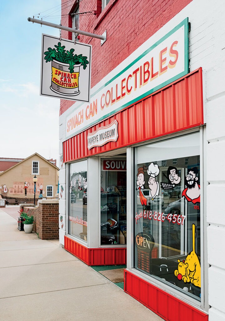
The Brookses are a baby boom couple without a baby — “only a dog,” says Debbie. In 1994, they moved to Chester to open Spinach Can Collectibles, a Popeye museum and memorabilia shop on State Street. It’s one lot over from the hamburger-wielding statue of J. Wellington Wimpy, who was based on William Schuchert, manager of the Chester Opera House, where Segar began working as a film projectionist when he was 12. (Spinach Can Collectibles occupies the opera house’s bottom floor.) Since Popeye attracted the Brookses to Chester, the Brookses pushed Chester to promote Popeye as a tourist attraction. After all, Metropolis, Illinois, a town no bigger than Chester, has a Superman statue and the Super Museum.
“When we moved here, they only had one statue,” Debbie says. “Why are they not capitalizing on it? People told us we were crazy. They said, ‘You’ll never make it.’ Now there are 18 statues and the police department has Popeye on their patches, the fire department too. We wanted to put Chester on the map.” (Chester is already on the map, as the site of Menard Correctional Center, the state’s largest prison, but the Brookses wanted a better map.)
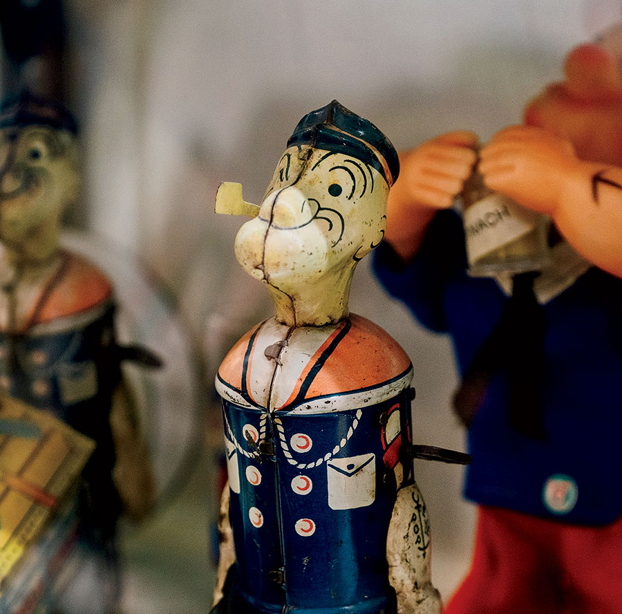
The Brookses also wanted to sell Popeye comic books, Popeye T-shirts, Popeye dolls, Popeye puzzles, Popeye postcards, Popeye pencils, and cans of spinach. The merchandise is in the front. In the back, encased in glass, is the Popeye collection that once filled the couple’s house: games, gumball machines, Pez dispensers, watches, telescopes, popcorn. Popeye was one of the most marketable comic strip characters in his day, but that day ended after the baby boomers, who still found black-and-white cartoons entertaining. The Brookses want to keep the store open until 2029, the 100th anniversary of Segar introducing Popeye in his Thimble Theatre strip. “Then we’ll hang it up,” Debbie says.
To find Kaskaskia, we cross an Erector set bridge into Perry County, Missouri, drive through miles of flat green farmland, then cross another bridge over a minor stream: the old Mississippi riverbed. A small, pocked black-and-white sign humbly announces, “Illinois State Line.” We are back in Randolph County.
Kaskaskia was Illinois’s capital for its first year of statehood, but now only 36 people live here, give or take, in ranch houses scattered across the fertile landscape. A visitor to the little white building, the size of a one-room schoolhouse, that holds the Kaskaskia Bell is unlikely to hear anything but a recorded voice. The bell was forged in France in 1741 and sent by King Louis XV to the parishioners of Immaculate Conception Church, whose current incarnation is next door. Since no one is around to tend the bell, I push a green button. The door pops open, and a deep voice tells the story of “the Liberty Bell of the West,” rung when George Rogers Clark (for whom Chicago’s Clark Street is named) captured Kaskaskia from the British in 1778. Kaskaskia’s bell is 11 years older than the bell in Philadelphia. So maybe that’s the Kaskaskia Bell of the East.
“Do you feel like you’re in Illinois?” I ask Dave.
“No. This feels like the South.”
“It is the South. Just wait. It’s going to get even more Southern.”
Cairo, Cairo is my baby’s home.
— Henry Spaulding, “Cairo Blues”
There are a couple of theories as to how southern Illinois came to be called Little Egypt. One is that the confluence of the Ohio and Mississippi Rivers resembles the Nile delta. The other is that a hard frost in 1831 forced northern Illinois farmers to travel south to buy feed for their livestock. Like the sons of Jacob in the Bible, they were said to be going down to Egypt for corn.
Little Egypt begins somewhere on the road between Chester and Cairo. The bluffs are steeper and the settlements so sparse that we worry about running out of gasoline before we run out of Illinois. We have 30 miles to go and 36 miles of gas. According to Google Maps, the only filling station on Illinois Route 3 closes in just a few minutes, at 6 p.m. But we want to make it to Cairo before 7, when Shemwell’s Barbecue closes. Shemwell’s is on almost every list of Illinois’s best barbecue.
“We may have to go over to Cape Girardeau to get gas,” I tell Dave, who’s driving. “But then we won’t get to Shemwell’s in time.”
“Let’s get you to your barbecue,” he says, pressing the pedal.
Fortune favors the bold. The pumps are still open at Jones Service Station, just south of Thebes, so we arrive in Cairo with a full tank and empty stomachs.
I knew Shemwell’s is the best restaurant in Cairo. I didn’t know it’s the only restaurant left in Cairo. Subway couldn’t make it here. COVID closed the Nu Diner. Alexander County, of which Cairo is the seat, lost 36 percent of its population in the last census, more than any other county in the United States. The Department of Housing and Urban Development closed two low-rise housing developments, dispersing 500 residents throughout southern Illinois, and is planning to shut down a high-rise next.
“Cairo has a heavy railroad and river trade, and her situation at the junction of the two great rivers is so advantageous that she cannot well help prospering,” Mark Twain wrote in Life on the Mississippi. Although Cairo is situated like Pittsburgh or St. Louis, its population is 1,659. Even in the 1930s, when Cairo was nine times as populous, The WPA Guide to Illinois noted that the levee surrounding Cairo had “no more than a half-dozen sternwheelers moored along its mile length” and the hotels, shops, and taverns were “deserted and falling to ruin, their weathered facades embellished with bracketed cornices, rows of dentils, and balconies of wrought iron.” The barges that replaced stern-wheelers bypassed Cairo. So did the railroads and the highways. The rivers that once brought trade to Cairo now isolate the town within its levees.
“It’s boring,” sums up Brittany, the Shemwell’s waitress who sets our plates on the counter. Shemwell’s barbecue is served between two slices of bread, with the sauce on the side. The TV behind the bar is showing Kentucky political ads. “We don’t have much here. No grocery store, pharmacy, or gas station. I go to Sikeston [in Missouri, 30 miles away] to buy groceries. We had one, two, three restaurants, then there was a couple bars here. There’s two liquor stores here. No place to sit down. People say they’re afraid to stay here, but I never lock my door. It’s not any worse than Chicago.”
To make ends meet, Brittany waits tables and drives a school bus. Why does she stay in Cairo, a place so many other young people have left?
“My dad,” she says in a soft Lower Mississippi drawl, sounding like she’s from Missouri or Arkansas rather than Illinois. “He was born and raised here. As long as he’s here, I’m here.”
Fort Defiance State Park, where the Ohio flows into the Mississippi, is the end of the road, the end of our journey down the river. Ulysses S. Grant brought thousands of troops here during the Civil War, not just because of Cairo’s strategic significance but also because the Union Army was afraid southern Illinois would defect to the Confederacy. This narrow peninsula at the confluence of the rivers is where Illinois dips its toe into the South. The bottom of the state could be called the Illinois delta. Along the Ohio River grow dozens of bald cypresses, the northernmost appearance of that Southern tree. The park’s concrete lookout stand offers views of Kentucky and Missouri. The Lower Mississippi begins here and ends in Louisiana.
“How long have you lived in Illinois?” Dave asks me as we drive to our hotel. We’re staying at the Americas Best Value Inn in Ullin, 20 miles north of Cairo, because the waitresses at Shemwell’s warned us that the hotel closer to town is a bedbug colony. Dave is trying to figure out why I’m an Illinois stateriot.
“Thirty years.”
“I think I have more of an appreciation for Illinois since I took this trip,” he says. “I didn’t have a sense of it. It’s not just flat and ugly. There are some nice people. I travel too much. It’s just sort of a base to work out of. It’s where I went to graduate school. I hardly interact with anyone from Illinois. Everyone in the art world is a transplant.”
The next morning, Dave needs real coffee. The hotel’s continental breakfast consists of Cap’n Crunch, corn flakes, and coffee in Styrofoam cups. There’s no coffee in Cairo, either.
“They don’t have any amenities here — not even a McDonald’s,” he says.
Cairo has a Dollar General, the most bottom-feeding discount chain in America, which sells bottles of Starbucks Frappuccino. That’s morning coffee in Cairo. I want to head over to Magnolia Manor, an 1869 mansion open for tours, but Dave is not eager to photograph “another historic site.” It’s a conflict between words and pictures. He wants to shoot everything that moves, I want to write about everything that doesn’t. His favorite photo on the trip is of a gay couple coming home from shopping in Chester.
We visit Magnolia Manor anyway. There’s not much else to see in Cairo. This morning, the mansion is closed to tourists. Buggies are parked along the curb. Men in frock coats and women in hoop skirts scurry through side doors. A sign warns that photography is prohibited.
“What’s going on here?” I ask a security guard.
“They’re filming a wedding scene for a movie, Letters Home. It’s a low-budget Civil War movie filmed in southern Illinois. John Wayne’s grandson John T. Wayne is in it.”
I spot the craft table.
“Have you got any coffee? I’m traveling with a photographer. He really wants coffee.”
Dave is invited to drink coffee. However, he is not allowed to photograph the magnolia tree on the front lawn, blooming with white flowers on this May morning.
Besides Shemwell’s and Dollar General, G&L Clothing is one of Cairo’s few remaining businesses. I am looking for a Cairo souvenir. G&L sells T-shirts commemorating Pyramid Courts and Elmwood, housing projects closed by HUD. They read “Cairo Matters” — a slogan predating “Black Lives Matter,” says owner Gabrielle Harris, a burly ex-athlete. “At the time, it was about getting people to understand that we were here,” he says. “When we had the flood in 2011, there was a politician that said, ‘Let it flood. Our farmland is more important.’ Cairo was evacuated for a month. Water was within a foot of the levee.”
If no one else has hopes for Cairo, Harris does. Seventeen years ago, he moved back from Tulsa, where he went to college, because he wanted to save his hometown. He’s on the board of a soon-to-open food co-op, which will replace the grocery store that closed in 2015. He’s enthusiastic about a planned $40 million port district, where barges can dock: “It’s really about reestablishing the connection to the Ohio and Mississippi and bringing in tourism. At one time, this was the hub of Illinois.”
It’s been a long drive from the northwest corner of our state, where Illinois meets Wisconsin and Iowa. We’ve followed the river for 580 miles — in few states is it even possible to drive that far in one direction. Did I find the exotic in Illinois? I think I did, because Illinois contains more of America than any state, and there’s no better place to look for it than on the most American river, the Mississippi.
I thank Harris for the T-shirt and ask him one last question.
“Have you ever heard of East Dubuque?”
He stares at me quizzically. “Never heard of it.”


