The geographic center of Chicago is at the corner of West 37th and South Honore streets in the McKinley Park neighborhood. Thus says a sign declaring it so. But I’ve always been curious about another center: the population center of Chicago.
A center of population is, according to the U.S. Census Bureau, “the point at which an imaginary, weightless, rigid, and flat (no elevation effects) surface representation of [a jurisdiction] would balance if weights of identical size were placed on it so that each weight represented the location of one person.” To put it more simply, half the people live north of a population center, half live south, half live east, and half live west.
The population center of the U.S. is in Hartville, Missouri. It moves south and west with each census. From the 1950s to the 1970s, it was in southern Illinois. The population center of Illinois is in Grundy County, just southeast of Morris, along the banks of the Mazon River. The population center of Cook County is at Latitude 41.869515 North, Longitude 087.757998 West, which is near where Laramie Avenue crosses the Eisenhower Expressway, in West Garfield Park.
The Census Bureau doesn’t calculate the population center of cities and towns, though. There are just too many. Since the Census Bureau won’t do it for me, I tried to figure out the population center of Chicago myself. I think I came up with a good answer.
My methodology involved using the populations of the city’s 77 community areas. Starting in the northeast corner of the city, I totaled up the population of each community area, tier by tier, until I reached 1,333,500, which was as close as I could get to half the city’s 2020 Census population of 2,746,388. I got to that figure in Austin. The southern boundary of Austin is Roosevelt Road, but the neighborhoods to its east, Humboldt Park and West Town, end at Kinzie. I chose a street in between as the north-south axis: Madison. This seemed appropriate. Madison is Chicago’s north-south zero street. If my calculations are correct, half of Chicagoans live on the North Side, and half live on the South Side. This would not only be accurate, but equitable.
For the east-west axis, I totaled the population of the community areas on the lakefront, then moved inland. I reached the halfway point in West Englewood. The western boundary of West Englewood is Western Avenue — Chicago’s longest street, and once its city limit. This, too, seemed appropriate: it would mean that half of Chicagoans live on the Northwest and Southwest sides, where they claim the other half of the city pays no attention to them.
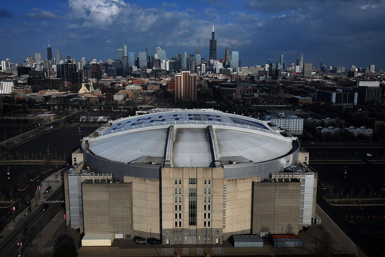
If my calculations are correct, the population center of Chicago is at Madison Street and Western Avenue, just west of the United Center, in East Garfield Park. Appropriately, that’s a bit north and east of the county’s population center. As the home of the Bulls, the United Center is indeed a spot that unites all Chicagoans. Only the Census Bureau can tell me for sure if I’m right, though. If a Census Bureau statistician wants to do the calculations, please forward me the results at emcclelland@chicagomag.com. If I am right, I want to see a sign at the corner, just like the sign for the geographic center of Chicago in McKinley Park.